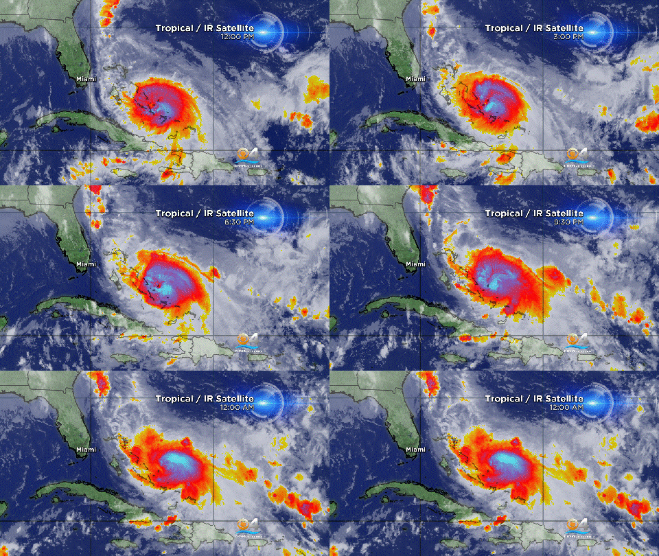
Joaquin Moving Away From Bahamas
Follow CBSMIAMI.COM: Facebook | Twitter
MIAMI (CBSMiami) - Joaquin is moving away from the Bahamas and hurricane conditions should begin to gradually subside.
At 11 p.m., the center of the Category 3 hurricane was about 60 miles south-southwest of San Salvador.
Maximum sustained winds were 125 mph. Hurricane force winds extend outward up to 50 miles from the center and tropical storm force winds extend outward up to 205 miles.
Some fluctuations in intensity are possible during the next 24 hours. Slow weakening is expected to begin on Saturday.
Joaquin is moving toward the northeast near 10 mph, and this general motion should continue with a gradual increase in forward speed during the next 48 hours. On the forecast track, the core of the strongest winds of Joaquin will continue to move away from the Bahamas.
A Hurricane Warning is in effect for the Central Bahamas; the Northwestern Bahamas including the Abacos, Berry Islands, Eleuthera, Grand Bahama Island, and New Providence; and the Acklins, Crooked Island, and Mayaguana in the southeastern Bahamas.
A Hurricane Watch is in effect for Bermuda.
Hurricane conditions are expected to continue across portions of the central and southeastern Bahamas through Friday. Hurricane and tropical storm conditions are also expected over portions of the northwestern Bahamas on Friday. Tropical storm conditions will affect other portions of the southeastern Bahamas, and the Turks and Caicos Islands on Friday.
A very dangerous and life-threatening storm surge will raise water levels by as much as 6 to 12 feet above normal tide levels in the central Bahamas in areas of onshore flow. A storm surge of 2 to 4 feet above normal tide levels is expected in the remainder of the Bahamas within the hurricane warning area. Near the coast, the surge will be accompanied by large and dangerous waves. Water levels should begin to subside overnight and on Saturday as Joaquin moves away from the Bahamas.
Joaquin is expected to produce additional rain accumulations of 2 to 5 inches over the Bahamas, eastern Cuba, Haiti, the Dominican Republic, and the Turks and Caicos Islands through Saturday. Isolated maximum storm-total amounts of 25 inches are possible in the central Bahamas. Outer rain bands of Joaquin will begin to affect Bermuda by early Sunday, and Joaquin is expected to produce 3 to 5 inches of rainfall over Bermuda through Monday. This rainfall could result in life-threatening flash floods.
Swells generated by Joaquin will affect portions of the Bahamas during the next few days. Swells have begun to affect portions of the southeastern coast of the United States and will spread northward along the east coast of the United States through the weekend. These swells are likely to cause life-threatening surf and rip current conditions. Even though Joaquin is expected to pass well east of the coast of the United States, a prolonged period of elevated water levels and large waves will affect the mid-Atlantic region, causing significant beach and dune erosion with moderate coastal flooding likely. Please consult products from your local weather office.
- Click here for ways to prepare yourself for an impending storm from the CBSMiami.com Hurricane Preps page
- Click here for the latest news surrounding hurricanes and the National Hurricane Center
- Click here to see all of the latest maps when a storm forms in the Atlantic
- Click here to download the CBS4 2015 Hurricane Guide (English)
- Click here to download the CBS4 2015 Hurricane Guide (Spanish)


