New Cold Front Brings Rain Chance Back to South Florida
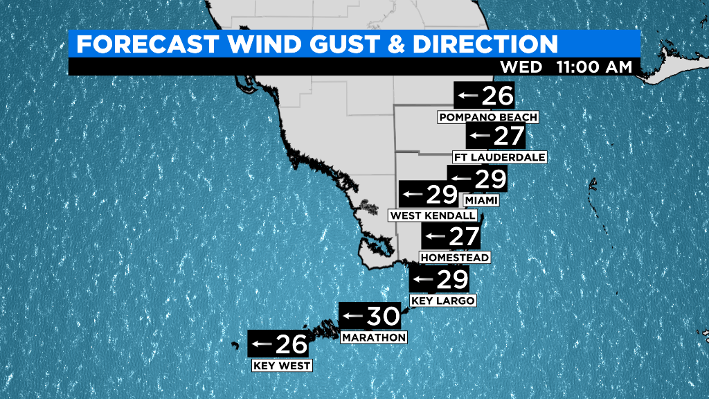
MIAMI (CBSMiami) -- A warm and windy pattern is settling into South Florida. Wednesday and Thursday will be the windiest with gusts 20 to 30 mph at times.
Expect afternoon highs in the upper 70s for Wednesday and Thursday with mainly dry conditions as the atmosphere remains stable across our area.
Friday will be warm and not as windy which will allow for temperatures to hit 80 degrees during the afternoon.
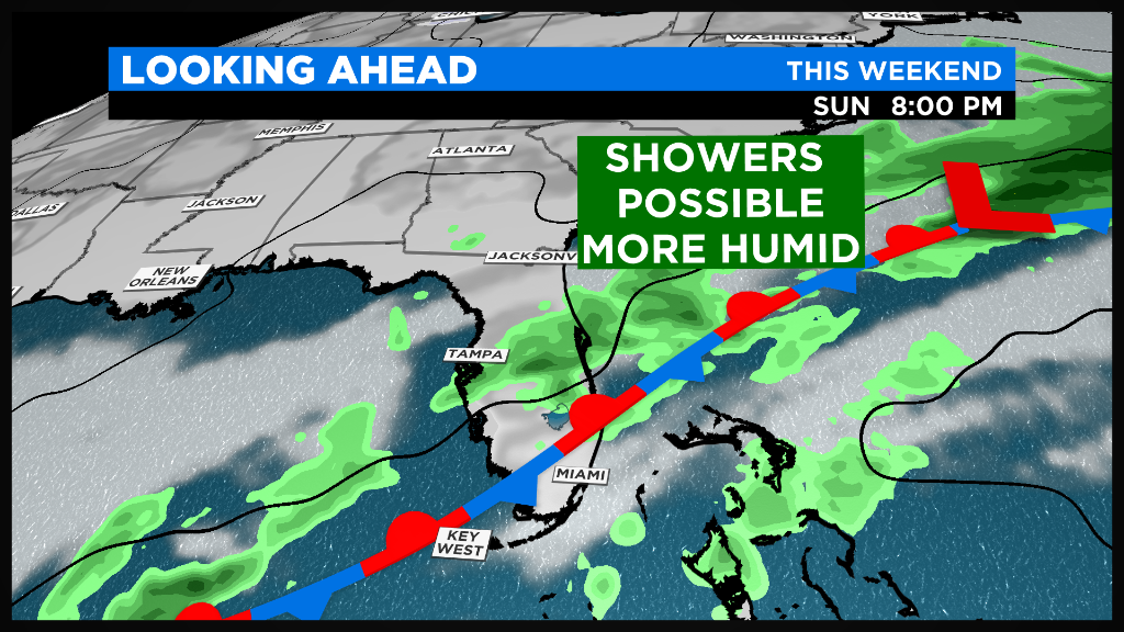
Moisture will creep in by Saturday and it will feel a bit more humid this weekend. This is happening before a cold front arrives Saturday afternoon.
The front will weaken and stall just north of South Florida which means temperatures remain warm, in the upper 70s or low 80s.
When it comes to rain, the cold front will only bring a slightly higher rain chance. The forecast still calls for a few showers Saturday night and on Sunday but this will not be a washout as the front will not carry enough moisture and instability.
By Monday, a secondary cold front will come in from the Gulf waters that will help to push the stationary front away from South Florida. A few showers are still possible Monday with clearing and drier weather returning next Tuesday.