Tracking The Tropics: Category 3 Hurricane Larry In The Atlantic, Disturbance In Southern Gulf Of Mexico
MIAMI (CBSMiami) - Larry remains a Category 3 hurricane in the Atlantic Ocean on Monday with sustained winds of 120 mph.
In the morning, Larry was located just over 1,000 miles southeast of Bermuda and continues to track toward the northwest. So, that distance between Bermuda and Larry is shrinking. Bermuda is just on the outside edge of the forecast cone and Larry is still expected to make its closest approach to the island on Thursday and pass of the islands.
Hurricane-force winds from the center extend outward up to 70 miles while tropical-storm-force winds extend outward up to 175 miles from the center. In the latest forecast cone from Monday morning, it is possible that Bermuda will be impacted by those outer tropical storm conditions throughout Thursday.
By Friday, Larry may be downgraded to a Category 2 hurricane and make a turn towards the north and then the northeast direction. Larry will then move over the northern waters of the Atlantic. Larry will remain away from the U.S. East Coast but dangerous surf and rip currents, and large swells can reach the coastal areas from the Mid-Atlantic to New England.
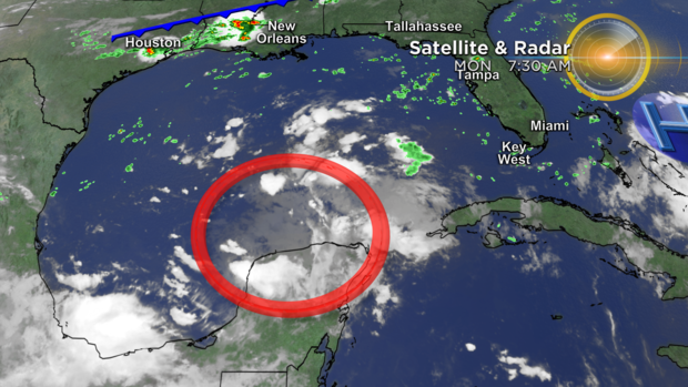
Another area that the CBS4 Weather Team is watching on Labor Day is a little closer to South Florida. It is a tropical disturbance that is producing disorganized showers and storms as it moves over the southern Gulf of Mexico and toward the northeastern Gulf Coast the next few days.
This disturbance, however, has a low chance of formation due to the strong upper-level wind shear.
Regardless of further tropical formation or not, it is expected that a surge of deep tropical moisture associated with the disturbance sweep across the southeast, including the Sunshine State.
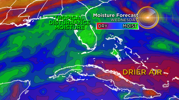
What this means in terms of South Florida's forecast is that rain chances will be high during Wednesday and Thursday. Gusty downpours will bring back the threat of flooding those two days. Then South Florida will look forward to an area of drier air coming in from the Atlantic that will push most of the moisture out of the area on Friday, in time for the weekend.
Forecast highs will top the lower 90s each afternoon this week with overnight lows in the upper 70s and low 80s.