More Cool Air Set To Pour Into South Florida
MIAMI (CBSMiami) - The weather Tuesday morning was comfortable across South Florida with temperatures in the low 60's. But, another cool down is in store for the area.
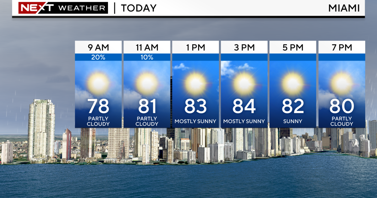
A few showers are moving in Tuesday morning ahead of the next cold front and throughout the day there will be a chance of scattered showers.
Clouds will be increasing and the breeze will be building. Winds will kick up over the next several hours and create hazardous marine conditions along with a high risk of rip currents.
Ahead of the cold front, temperatures should reach into the upper 70's Tuesday afternoon before the cold front sweeps through this evening and temperatures plummet to the low 50's near the coast and 40's across the rest of the area.
The winds will make it feel even colder with wind chills in the low 40's near the coast and possibly the upper 30's further inland.
By Thursday afternoon, there will be some winter sunshine with highs making it into the low 70's before another cold front moves through on Friday which will reinforce the cold air already in place.
Friday morning, temperatures will be in the upper 40's and highs will only make it into the upper 60's.
Finally, this weekend will bring a warming trend, but the cool nights will remain in place with lows in the 50's and highs in the 70's on both days.