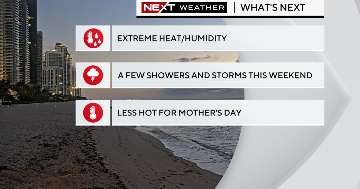
Temperatures About To Tumble
MIAMI (CBSMiami) -- Winter officially kicked off Friday morning at 6:12 a.m. with the Winter Solstice and it will feel more like winter South Florida style later in the day and into the weekend due to a strong cold front moving through.
The coldest air of the season will move in and throughout the day temperatures will hold steady and then fall into the upper 50s by this evening.
Friday night, lows will drop dramatically to the low 40s inland and the mid to upper 40s near the coast.
A wind chill advisory has been issued tonight from 11 p.m. until 8 a.m. for Inland Broward and Palm Beach counties.
The combination of the gusty northwesterly winds and lows in the 40s will help to make it feel more like 25 to 35 degrees for the coldest inland locations.
You should bring in pets and sensitive plants.
Ahead of the front a few showers moved quickly across portions of South Florida Friday morning and already the winds are shifting out of the northwest from 15 to 25 mph. That northerly wind will help to transport the cold air and Saturday, highs will only reach the mid 60s with plenty of cool sunshine.
The second night after a cold front has moved through is usually colder and that will be the case this weekend.
Saturday night into Sunday some inland areas will fall to around 40 degrees with the mid 40s near the coast.
The high on Sunday afternoon will be around 70-degrees.
There will be a gradual warming trend early next week with lows in the low 50s Christmas Eve and a high of 76.
On Christmas Day, early morning lows will be in the 60s and highs will be pleasant with the upper 70s.