Wednesday Will Be Hot, Hot, Hot
Follow CBSMIAMI.COM: Facebook | Twitter
MIAMI (CBSMiami) - We're in for another scorcher across South Florida.
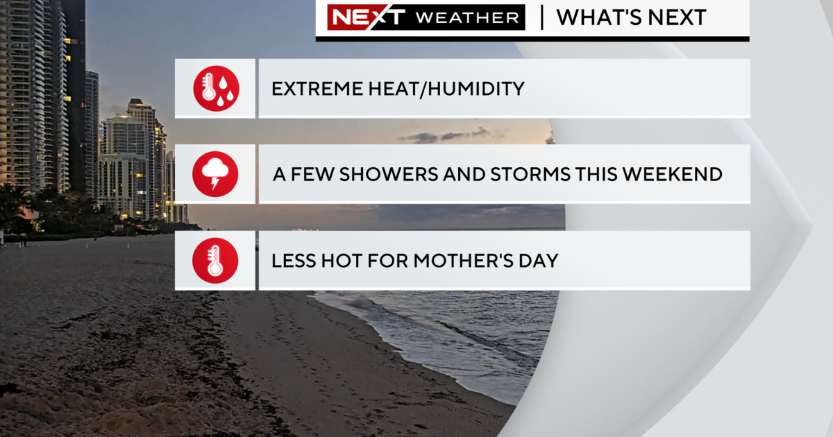
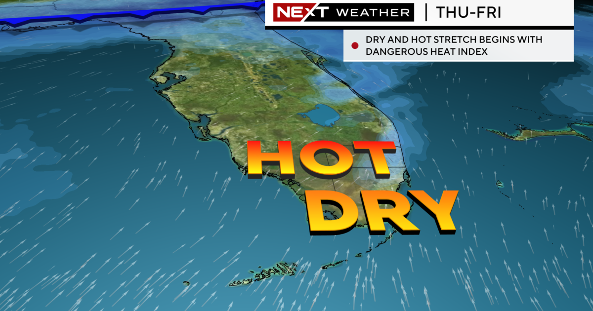
On Wednesday, record heat is possible with high pressure in control and rain chances remaining very low. There's a chance that we could see a shower or two since we have a southeast onshore breeze. Some stray storms may pop up in the afternoon out west.
Hazy sunshine due to Saharan air will allow temperatures to climb quickly. We had a very warm and steamy start with low temperatures in the mid 80s with 'feels like' temperatures in the low to mid 90s.
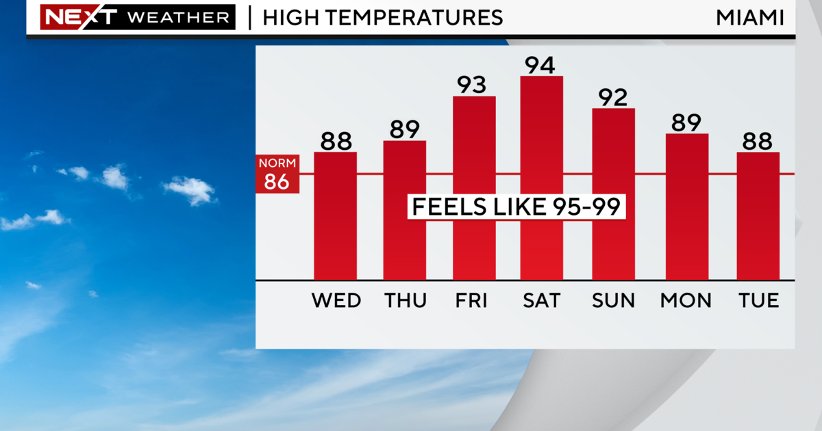
Highs will soar to the low 90s in the afternoon and we could break some records. The CBS4 Weather Team is forecasting a high of around 93 degrees for Miami, Ft. Lauderdale and Key West. The old record in Miami was 95 set back in 2009. The old record in Ft. Lauderdale was 97 degrees set back in 1954. And record high in Key West was 95 set back in 1881.
When you factor in the high humidity, it will feel like the 100s. A heat advisory was issued yesterday due to the extreme heat and once again today another heat advisory may be issued urging South Floridians to take the necessary precautions since heat illness may be possible.
Some heat safety tips include:
*Stay hydrated by drinking plenty of fluids.
*Stay in the air conditioning, the shade and out of the sun when possible.
*Limit outdoor activity.
*Wear light weight, loose fitting clothing.
*Check on the elderly, pets and anyone without A/C.
*Also, do not leave children or pets in hot cars. Look before you lock.
Wednesday night will be warm and muggy with low 80s and mainly dry conditions.
Hazy, hot, humid weather continues the next few days. We may tie or break some records. We'll start to see temperatures drop a few degrees this weekend with a better chance of rain Sunday.