Miami Weather: Showers Return To South Florida
MIAMI (CBSMiami) -- Showers return to South Florida beginning Tuesday night.
There is a low-pressure system in the Gulf of Mexico that is moving towards the Florida West Coast so plenty of moisture is surging back into our area.
The rain arrives on Tuesday night with spotty showers. Then cloudy skies are in store for Wednesday morning with muggy and milder conditions.
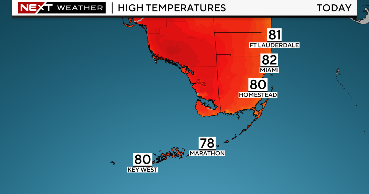
Morning temperatures on Wednesday will be in the mid and upper 60s with afternoon highs in the mid to upper 70s.
South Florida needs to be prepared with an umbrella during the mid-afternoon and through the early evening hours on Wednesday as a round of showers will develop and move quickly form west to east across Broward and Miami-Dade.
Cloudy skies with few breaks of sun are expected Thursday and Friday because the area of low-pressure stalls just off the east coast of Florida and so a northeast wind will help to use Atlantic moisture to form more clouds.
Highs on both Thursday and Friday will be in the upper 70s or near 80 degrees while the morning temperatures will be in the 60s.
A strong cold front will slide south across the Sunshine State this weekend. This will push the low further away from Florida and bring down the rain chance to a stray shower for Friday afternoon.
However, rain is forecast for Saturday morning along the front then drier conditions will return later in the day.
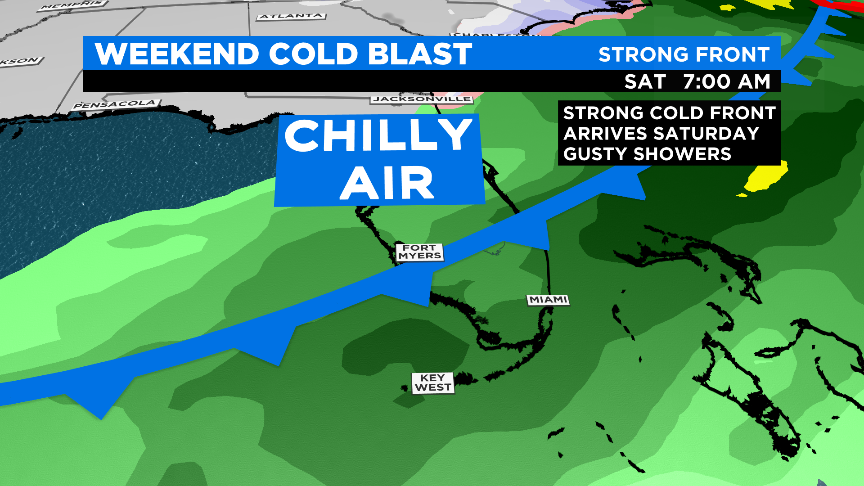
A chilly blast is expected to arrive on Saturday with this front and this cold air stays in South Florida at least through Monday.
Temperatures will be dropping this weekend to the lower 60s for daytime highs and the 40s during the nighttime and morning lows.
We'll have to watch out for a gusty northwest wind this Sunday that can make the wind chill factor to be colder than the 40s.