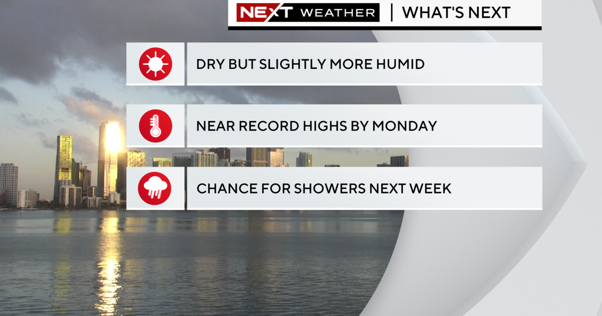
Miami Weather: Another Cold Front On The Way
MIAMI (CBSMiami) – Miami (CBSMiami)--It's all about the wind direction Sunday. Gusty south wind develops early bringing back the warm air, a colder west-northwest breeze returns at night dropping our temperatures. In between the two will be gusty storms with downpours and lightning.
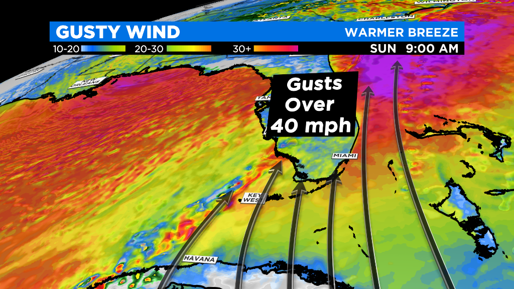
The wind gusts will create a hazard for boaters in the Keys and off the east coast. 40 mph gusts are possible especially in and around storms which will be developing along the cold front which is forecast to move through Monday afternoon.
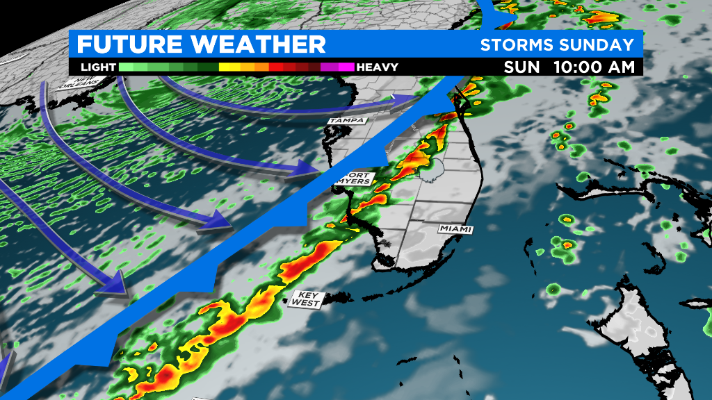
Strong to severe storms are likely along the Gulf Coast Sunday evening. Storms will be impacting the Lower Keys late morning before the storms move across the Florida Peninsula by Sunday afternoon.
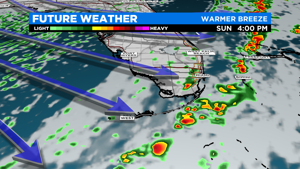
Even though the storms may weaken slightly as they move across the Florida Peninsula, brief downpours and strong wind gusts are still possible in and around them. Likely time of the strongest storms here in Broward and Miami-Dade counties looks like mid-afternoon.
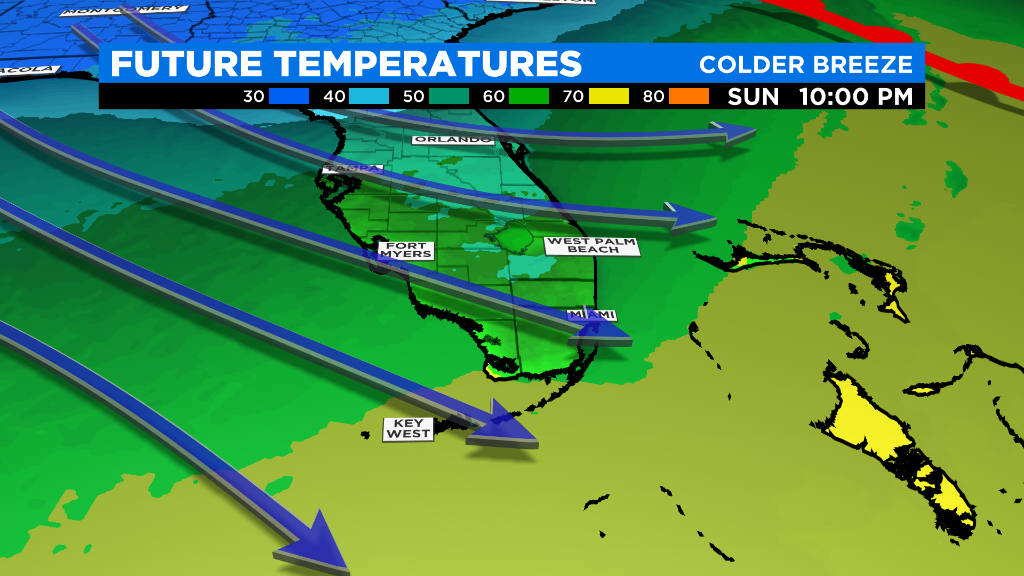
Colder air will move in behind the cold front Sunday night. Depending on how quickly the warm breeze develops in the morning, we may set our low temperature Sunday just before Midnight Monday.
Skies will clear Monday but the breeze will continue to bring in colder air throughout the afternoon and evening. Coldest morning will be Tuesday with lows in the lower 50s or even the upper 40s.