Hurricane Sally's Outer Rain Bands Moving Onshore In Florida Panhandle
MIAMI (CBSMiami) – Hurricane Sally's outer rain bands are moving onshore in the Florida Panhandle.
At 11 p.m. Monday, the center of Sally was about 130 miles southeast of Biloxi, Mississippi.
Sally is moving toward the west-northwest near 3 mph and this motion is expected to continue through Tuesday morning.
A northward turn is likely by Tuesday afternoon, and a slow north-northeastward to northeastward motion is expected Tuesday night through Wednesday night.
On the forecast track, the center of Sally will move near the coast of southeastern Louisiana tonight and Tuesday, and make landfall in the hurricane warning area Tuesday night or Wednesday.
Maximum sustained winds are near 100 mph with higher gusts.
Some strengthening is forecast early Tuesday and Sally is expected to be a dangerous hurricane when it moves onshore along the north-central Gulf coast.
Hurricane-force winds extend outward up to 45 miles from the center and tropical-storm-force winds extend outward up to 125 miles.
A buoy south of Dauphin Island, Alabama, recently reported sustained winds of 61 mph (98 km/h) and a wind gust of 69 mph.
SUMMARY OF WATCHES AND WARNINGS IN EFFECT:
A Hurricane Warning is in effect for:
- Morgan City Louisiana to the Alabama/Florida border
- Lake Pontchartrain and Lake Maurepas including metropolitan New Orleans
A Tropical Storm Warning is in effect for:
- Alabama/Florida border to Indian Pass Florida
- Intracoastal City Louisiana to west of Morgan City
A Tropical Storm Watch is in effect for:
- Indian Pass to Ochlockonee River Florida
A Storm Surge Warning is in effect for:
- Port Fourchon Louisiana to the Alabama/Florida border
- Lake Pontchartrain, Lake Maurepas, and Lake Borgne
- Mobile Bay
In addition to Sally, there are six other systems being tracked in the tropics during this busy hurricane season.
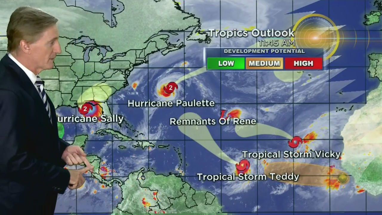
For the named systems, we have Hurricane Paulette, Tropical Storm Teddy, Tropical Depression Rene and Tropical Storm Vicky.
Forecasters are also keeping an eye on disorganized showers and thunderstorms over the western and southwestern Gulf of Mexico are associated with a weak area of low pressure. This system is not expected to develop due to strong upper-level winds.
Finally, tropical wave near the west coast of Africa is producing disorganized shower and thunderstorm activity. Environmental conditions appear to be conducive for slow development of the system this week as the wave moves westward at about 10 mph over the far eastern tropical Atlantic.