Tracking The Tropics: Gulf Disturbance Expected Strengthen In Tropical Storm, Hurricane
MIAMI (CBSMiami) – A Storm Surge Watch and a Tropical Storm Watch have issued ahead of the formation of a tropical cyclone in the northern Gulf of Mexico.
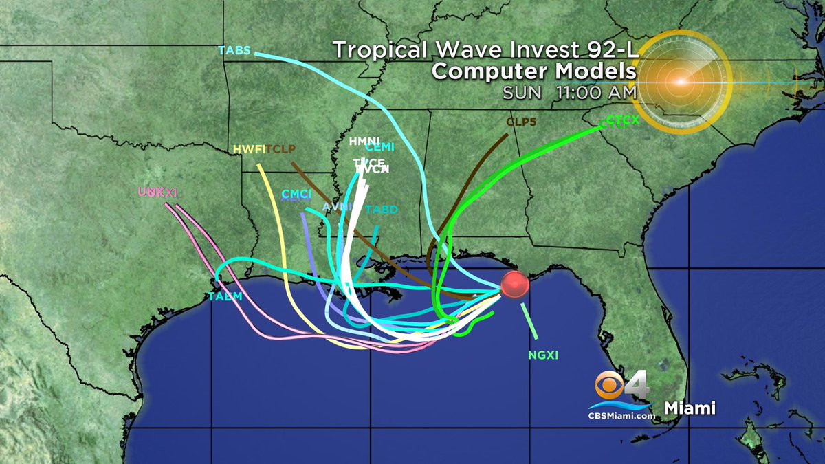
At 11 p.m., the center of the potential tropical cyclone 2 was about 240 miles east-southeast of Morgan City, Louisiana. The system, which has maximum sustained winds of 30 mph, was moving to the west-southwest at 8 mph.
The Storm Surge Watch extends from the Mouth of the Pearl River to Morgan City, Louisiana. The Tropical Storm Watch runs from the mouth of the Mississippi River to Morgan City.
The system is forecast to continue moving toward the west-southwest or southwest through Thursday morning, followed by a turn toward the west late Thursday and a turn toward the west-northwest on Friday.
By early Saturday, a northwest motion is expected. On the forecast track, the system is expected to approach the central U.S. Gulf Coast this weekend.
Strengthening is forecast during the next 72 hours, and the disturbance is forecast to become a tropical depression Thursday morning, a tropical storm Thursday night, and a hurricane on Friday. When it does, it will be named Barry.
Heavy rain and flooding is likely along the Gulf coast from Texas to the Florida panhandle.
The system is expected to produce total rain accumulations of 6 to 12 inches near and inland of the central Gulf Coast through early next week, with isolated maximum rainfall amounts of 18 inches.
Hurricane Hunters are scheduled to investigate this system later this afternoon.
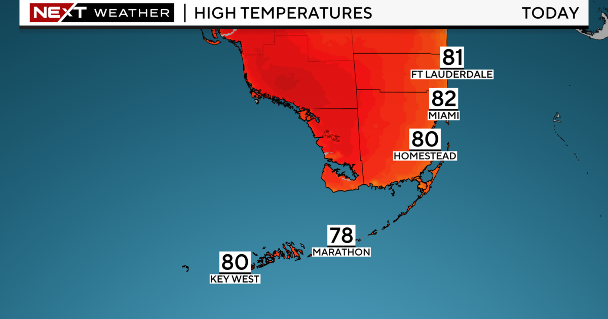
It is not a threat to South Florida.