Another Chilly Morning Before Warming Trend Kicks In
Follow CBSMIAMI.COM: Facebook | Twitter
MIAMI (CBSMiami) - It was a chilly start to Tuesday morning.
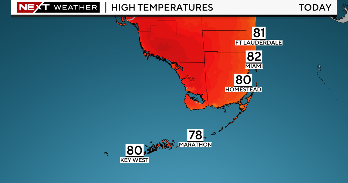
Broward and Miami-Dade saw temperatures in the low to mid-50s. Some areas were five to 10 degrees cooler in comparison to Monday. Lows were below our average low of 60 degrees. It was even cool across the Keys with temperatures in the mid to upper 60s.
It will be a beautiful day ahead with plenty of winter sunshine. We have cool and dry air mass in place in the wake of the front that moved through on Monday. We will enjoy lower humidity and pleasant highs in the low to mid-70s.
Tuesday night will likely be a bit colder as northerly winds persist and clearer skies allow cooler air to settle in.
Lows will fall to the low to mid-50s overnight.
Wednesday afternoon we'll continue to enjoy comfortable highs in the low to mid-70s.
High pressure remains in control the next few days and we'll enjoy a quiet weather pattern with cool nights and pleasant afternoons.
Thursday lows start to creep back into the upper 50s and highs will be back to normal in the upper 70s.
By Friday morning we'll wake up with lows right around 60 degrees. Highs climb to the upper 70s Friday afternoon.
The warming trend will continue into the weekend as high pressure moves eastward into the Atlantic and more of an onshore wind off the ocean will help to warm our temperatures and bring back the humidity.
This Saturday lows will be close to the mid-60s and highs right around 80 degrees. It will be even warmer on Sunday with the chance for breezy showers ahead of our next cold front.
Models are forecasting the coldest air of the season will arrive with this Arctic front by next Monday with highs only in the low 60s.