Chief Meteorologist Craig Setzer Explains Why Hurricanes Turn North
Follow CBSMIAMI.COM: Facebook | Twitter
MIAMI (CBSMiami) – Hurricane Irma is moving over Cuba, and everyone wants to know: when will it change directions and head toward South Florida?
CBS4 Chief Meteorologist Craig Setzer spent a year working on a model that explains why hurricanes turn north.
If you've ever look at a topographical map, it shows high mountainous terrain that you would hike, and low valleys.
In the atmosphere, you will find the same thing: valleys and mountains. The winds in the atmosphere flow around the valleys and mountains.
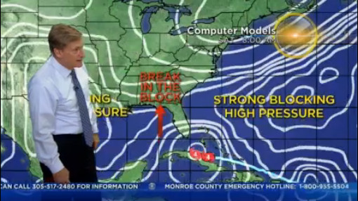
Setzer's model shows off the steering currents in the atmosphere. Using Irma as the example, Setzer pointed to a "strong blocking high pressure" in the east.
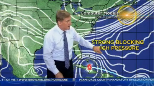
The spaghetti-like strands of currents wrap around each other, pushing down on Irma and keeping the storm on its forecast track.
The edge of the eastern strong blocking pressure sits across from another blocking high that isn't as strong.
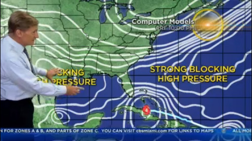
The gap where the two meet is what meteorologists call a "break in the block."
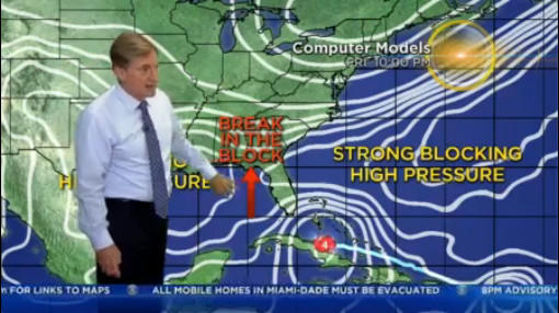
That break provides an opportunity for Irma, or any hurricane for that matter, to turn north.
The difficult thing about forecasting a hurricane's path is that the storm isn't moving on a fixed map – all of this stuff is moving. There are waves in the jet stream coming down, pushing against the block, and the block sometimes retreats, so patterns are changing and evolving. Meteorologists then try to predict what happens near the break in the block.
Basically, the hurricane is a stick in a current or stream. Meteorologists then try to predict what happens near the break while the shape in the "river" changes.
When Setzer puts his model into motion, the block opens up, giving the hurricane a chance to move north.
As the storms moves north, going through Florida, it begins creating its own big "low pressure" area in the atmosphere.
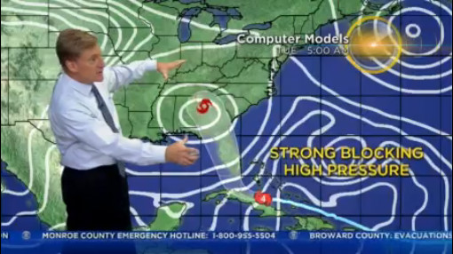
Really, Setzer says, the skill is trying to predict how the storm will go through that block.
For us, living here five miles, 10 miles, 20 miles, 50 miles – all of that makes it a big difference. It is the intense part we want to keep away.