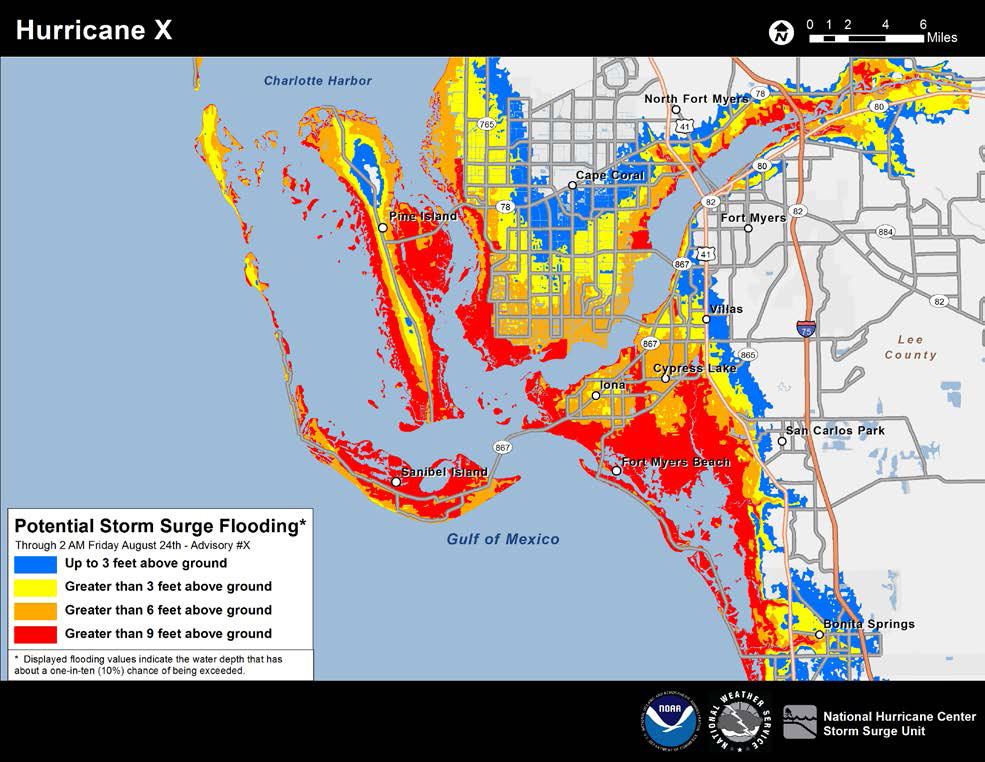
NHC To Issue New Potential Storm Surge Flooding Map
MIAMI (CBSMiami) – The National Hurricane Center and National Oceanic and Atmospheric Administration announced Friday plans to issue a new Potential Storm Surge Flooding Map during the 2014 Atlantic hurricane season.
It is an experimental map that was developed over several years with the help of emergency managers, broadcast meteorologists, and other experts.
Meteorologists hope the map will help the public better understand storm surge and why it is a threat to the coast of Florida and hurricane prone areas.
The new map will show the geographical areas where inundation from storm surge could occur and how high above ground the water could reach in those areas.
It will be issued at the same time a hurricane watch or possibly a tropical storm watch is issued and will be based upon the storm's latest track and intensity. The idea is to give worst-case scenario for any given location for potential storm surge flooding.
Meteorologists say the map will also take into account forecast errors as they occur and subject to change every six hours as the National Hurricane Center issues advisories.
However, the map will not be available for about 45 to 60 minutes after the advisory because of the time it takes to process the map.
Click here for an example of the map.
The Atlantic hurricane season begins June 1.


