CBS News Live
CBS News Miami: Local News, Weather & More
CBS News Miami is your streaming home for breaking news, weather, traffic and sports for the Miami area and beyond. Watch 24/7.
Watch CBS News
Breaking Local News, NEXT Weather & Community Journalism
CBS News Miami is your streaming home for breaking news, weather, traffic and sports for the Miami area and beyond. Watch 24/7.


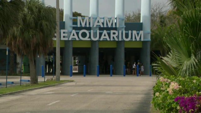
Two days before the order to vacate the Virginia Key premises, the owner of the Miami Seaquarium announced Friday the filing of a federal lawsuit against Miami-Dade County.
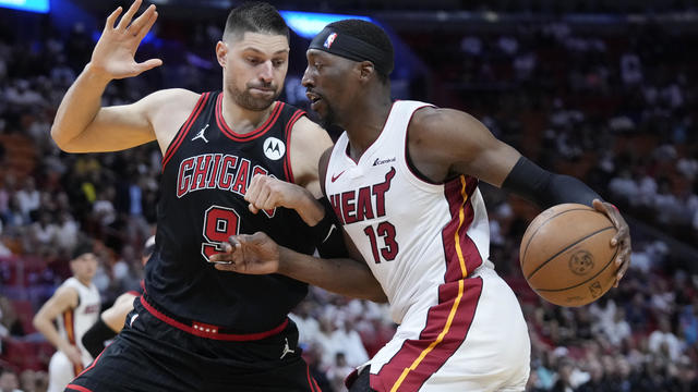
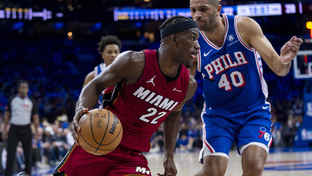
Tyler Herro scored 24 points and was an assist shy of a triple-double, rookie Jaime Jaquez Jr. added 21 points and the Miami Heat grabbed the last spot in the Eastern Conference playoffs, running away from the Chicago Bulls 112-91 in a play-in tournament elimination game.

An altercation between two people in the parking lot of a Publix supermarket in Miramar led to a shooting Friday evening, according to Miramar police.
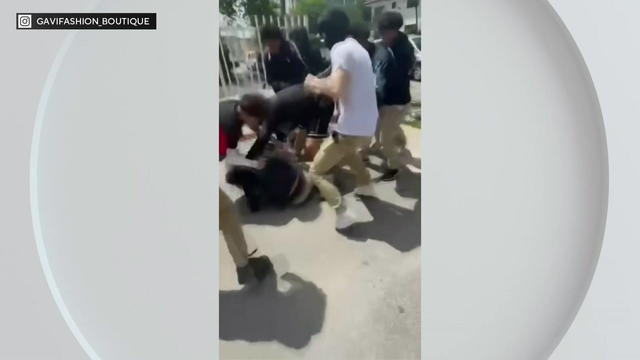
Miami police are investigating an attack on two youngsters near a charter school on Thursday afternoon and the brutal assault was captured on cell phone video.
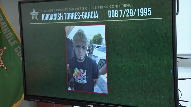
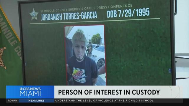
The Seminole County Sheriff held a news conference Friday afternoon to announce that a person of interest has been named in a deadly carjacking and kidnapping of a South Florida woman.
Bob Graham, a two-term Florida governor who went on to serve in the U.S. Senate, will lie in state at the Historic Capitol Museum on Friday, April 26.

Entering its third year, Miami has been chosen as one of the only six venues to host an F1 Sprint in 2024, meaning there will be an extra race held that Saturday and guaranteeing high-octane action throughout the weekend.
The Dolphins have a first-round draft pick for the first time since 2021

A committee on Friday narrowed down options for the site of a Florida Museum of Black History, selecting as finalists St. Johns County, Eatonville in Orange County and Opa-locka in Miami-Dade County.
The innovative program launched at JC Bermudez Doral Senior High School is making Miami Proud

The challenges of growing up without a father figure are experienced every day by young women

Plastic and reconstructive surgeon Dr. Joshua Lampert will host a charity surgery day in honor of his mother who very instrumental in his life

Case is a successful businesswoman, generous philanthropist, mentor, and 2024 TIME Dealer of the Year

A person self-immolated at a park across from the courthouse where former President Donald Trump's New York criminal trial is taking place.

The jury selection process in former President Donald Trump's New York trial came to a close on Friday, part of a flurry of activity that marked the end of a dizzying first week.

Two U.S. officials tell CBS News an Israeli missile has hit Iran in apparent retaliation for the recent drone and missile attack on the Jewish state.

Cuba's deputy foreign minister tells CBS News that his country is willing to accommodate more than one deportation flight per month.
Tyler Herro scored 24 points and was an assist shy of a triple-double, rookie Jaime Jaquez Jr. added 21 points and the Miami Heat grabbed the last spot in the Eastern Conference playoffs, running away from the Chicago Bulls 112-91 in a play-in tournament elimination game.
The results are in: Jimmy Butler is out.
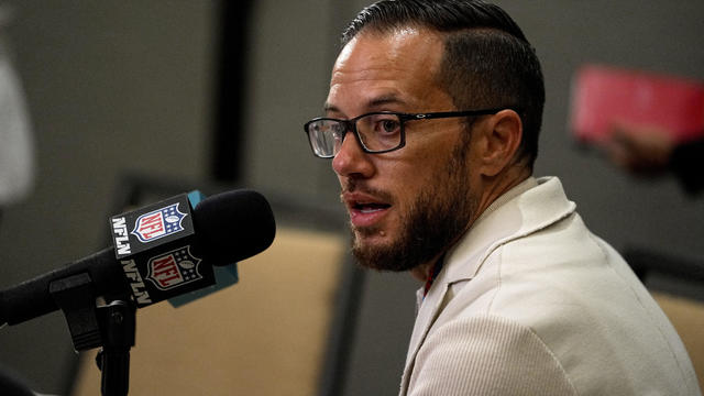
Mike McDaniel joked during last year's NFL draft that he couldn't wait to finally have a first-round pick.

The Cavinder twins are back at Miami.
The Dolphins have a first-round draft pick for the first time since 2021
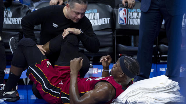
Miami guard Jimmy Butler says he will need an MRI on his right knee

The No. 1 pick in this year's WNBA draft is "going to raise all boats" for players in the league, one expert said.
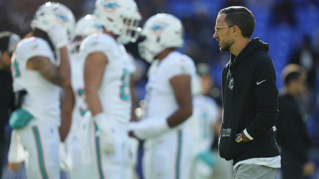
The Miami Dolphins announced Wednesday they have signed linebacker Cam Brown as an unrestricted free agent from the N.Y. Giants.
Joel Embiid had 23 points, 15 rebounds and one huge assist to Kelly Oubre Jr. on a late go-ahead three-point play that led the 76ers to a 105-104 win over the Miami Heat in the Eastern Conference play-in tournament on Wednesday night.
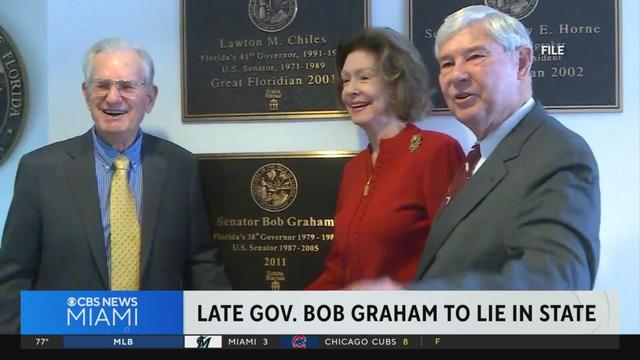
Bob Graham, a two-term Florida governor who went on to serve in the U.S. Senate, will lie in state at the Historic Capitol Museum on Friday, April 26.
CBS News Miami's Nikiya Carrero reports on the latest developments regarding the case of a carjacked Homestead woman feared dead.
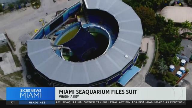
Two days before the order to vacate the Virginia Key premises, the owner of the Miami Seaquarium announced Friday the filing of a federal lawsuit against Miami-Dade County.
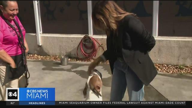
If you're thinking about it or have plans to adopt, Miami-Dade Animal Services could use the help. Their main shelter in Doral is at capacity and they've had to use their backup facility in Medley to house rescued and abandoned dogs.
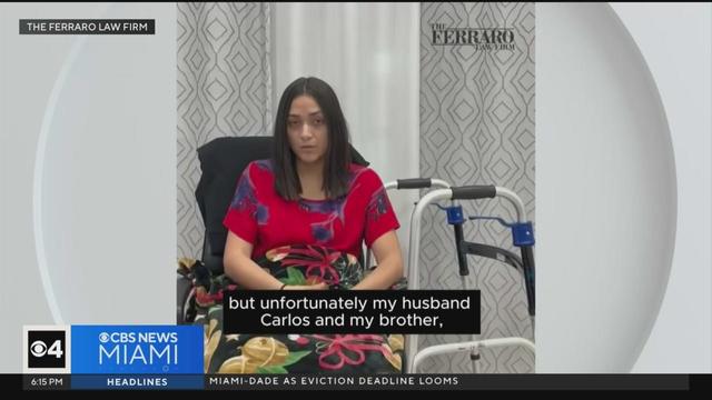
The victims of the shooting at Martini Bar at CityPlace Doral earlier this month file a lawsuit.
Two days before the order to vacate the Virginia Key premises, the owner of the Miami Seaquarium announced Friday the filing of a federal lawsuit against Miami-Dade County.
Tyler Herro scored 24 points and was an assist shy of a triple-double, rookie Jaime Jaquez Jr. added 21 points and the Miami Heat grabbed the last spot in the Eastern Conference playoffs, running away from the Chicago Bulls 112-91 in a play-in tournament elimination game.
An altercation between two people in the parking lot of a Publix supermarket in Miramar led to a shooting Friday evening, according to Miramar police.
Miami police are investigating an attack on two youngsters near a charter school on Thursday afternoon and the brutal assault was captured on cell phone video.
The Seminole County Sheriff held a news conference Friday afternoon to announce that a person of interest has been named in a deadly carjacking and kidnapping of a South Florida woman.
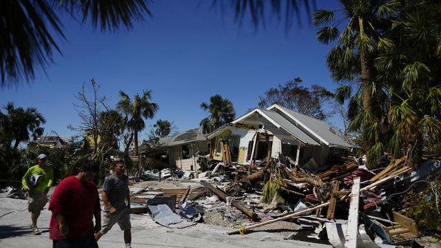
Florida insurance companies made money last year for the first time in seven years.

The U.S. Supreme Court is scheduled Sept. 26 to discuss whether it will hear a First Amendment challenge to a 2021 Florida law that placed restrictions on major social-media companies.

The number of people traveling to Florida during the second quarter of 2023 decreased compared to a year earlier, according to estimates released Wednesday by the state's tourism-marketing agency.

Gov. Ron DeSantis on Monday said Walt Disney Parks and Resorts should drop a federal lawsuit that claims retaliation by the state and accept changes to a special district that long benefited the theme-park giant.

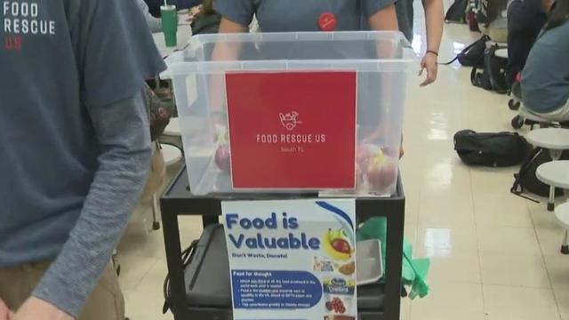
It's Back-To-School and that also means back to the lunch room, as breakfast and lunch are free to all Miami-Dade public school students again this year.
A person self-immolated at a park across from the courthouse where former President Donald Trump's New York criminal trial is taking place.
The jury selection process in former President Donald Trump's New York trial came to a close on Friday, part of a flurry of activity that marked the end of a dizzying first week.
Two U.S. officials tell CBS News an Israeli missile has hit Iran in apparent retaliation for the recent drone and missile attack on the Jewish state.
Cuba's deputy foreign minister tells CBS News that his country is willing to accommodate more than one deportation flight per month.
Details of his trip to Tampa have not been released
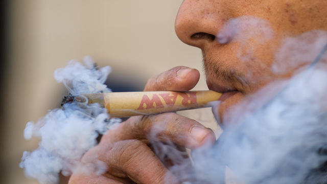
Jim DeFede talks to the CEO of Trulieve, the cannabis company that spent $40 million to gather the signatures to get the measure on the ballot.
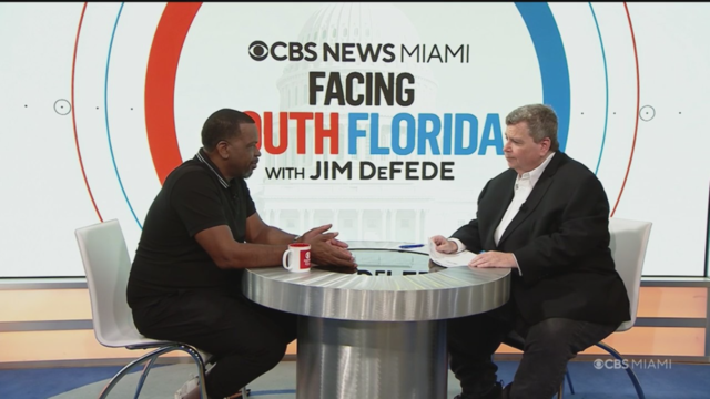
Jim DeFede goes one-on-one with the political and community activist and former rap superstar, who talks about making a run for the Rep. Sheila Cherfilus-McCormick's seat.

CBS News Miami's Jim DeFede speaks to attorneys about Rundle's tenure as Miami-Dade State Attorney.

CBS News Miami's Jim DeFede talks to State Senator Lauren Book about what the Florida Supreme Court has to say about the subject.
Jim DeFede speaks with the head of Florida Decides Healthcare, who is working to get a constitutional amendment to expand Medicaid on the ballot in 2026.

Health officials are warning consumers not to consume Infinite Herbs basil sold at some Trader Joe's and Dierberg's stores after 12 people were sickened.

Organic option is best when buying certain produce, especially blueberries, nonprofit group says in analysis of chemical residues.

The $872 million most likely excludes any amount UnitedHealth may have paid to hackers in ransom.
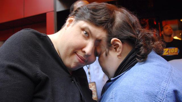
George Schappell and sister Lori, of Reading, Pa., were the world's oldest conjoined twins, according to the Guinness Book of World Records.

Most worrisome gaps involve cancer chemotherapy drugs, ER medications and and therapies for ADHD.

Find that special someone by signing up for one of the undeniably best dating apps in 2024.

Give your grad the best of the best for downtime enjoying music, listening to podcasts, or watching movies and TV.

These luggage pieces from Rimowa, Away, Monos and more are made to last a lifetime. Here's where to buy them now.
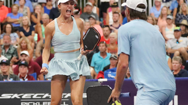
Find out how and when to watch the US Open Pickleball Championships, including who's competing.

Discover the best smart grills that make your outdoor grilling easier and more fool-proof than ever.

Has mom and dad's bank been open too long at your house?
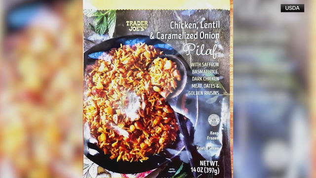
One consumer reported suffering a dental injury after eating Trader Joe's Chicken, Lentil & Caramelized Onion Pilaf product.

The company will keep its name and headquarters in Pittsburgh, but the United Steelworkers union voiced opposition to the deal.

For customers of SmileDirectClub, they were greeted with a message that they had shut down when logging on to its website.
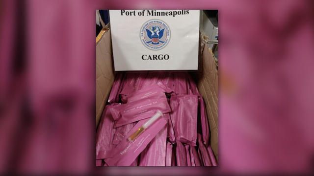
CBP officials say the individually wrapped pink packages have an estimated resale value of more than $19,000.

Anticipation was growing at a fever pitch before Taylor Swift's latest album, "The Tortured Poets Department," dropped at midnight EDT. But it turned out it's actually a double album.
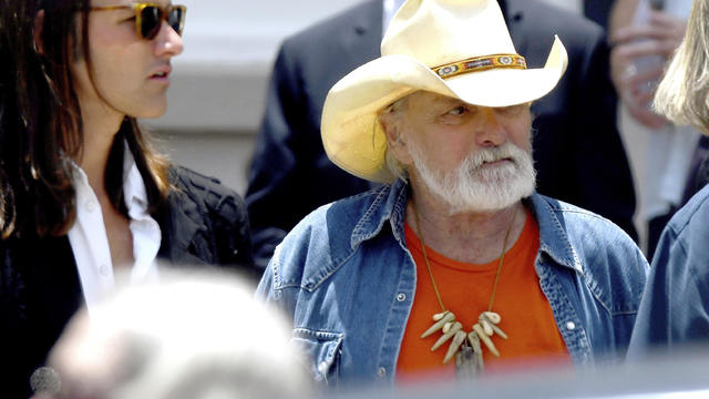
Guitar legend Dickey Betts, who co-founded the Allman Brothers Band and wrote their biggest hit, "Ramblin' Man," has died.

The singers first dated in 2003 and delighted fans when they rekindled their relationship in 2023.

The 2024 Latin Grammys will return home to Miami — where the organization is headquartered.
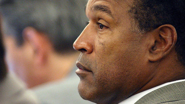
O.J. Simpson's longtime lawyer in Las Vegas says the end came quickly.