The Timeline: When Will We Feel Irma's Impact?
Follow CBSMIAMI.COM: Facebook | Twitter
MIAMI (CBSMiami) -- The window to finish all preparations ahead of Hurricane Irma is rapidly closing.
Overnight Friday night, the first outer bands from Irma will move through the area bringing with them periods of heavy rain and tropical storm force winds. The wind may first be gusting over 40 mph but will become sustained at that speed overnight Friday to early Saturday.
MORE: Latest Hurricane Irma Updates
During the day Saturday it will become nearly impossible to do anything but simple final preparations indoors. Make sure that you are where you want to be for the duration of the storm.
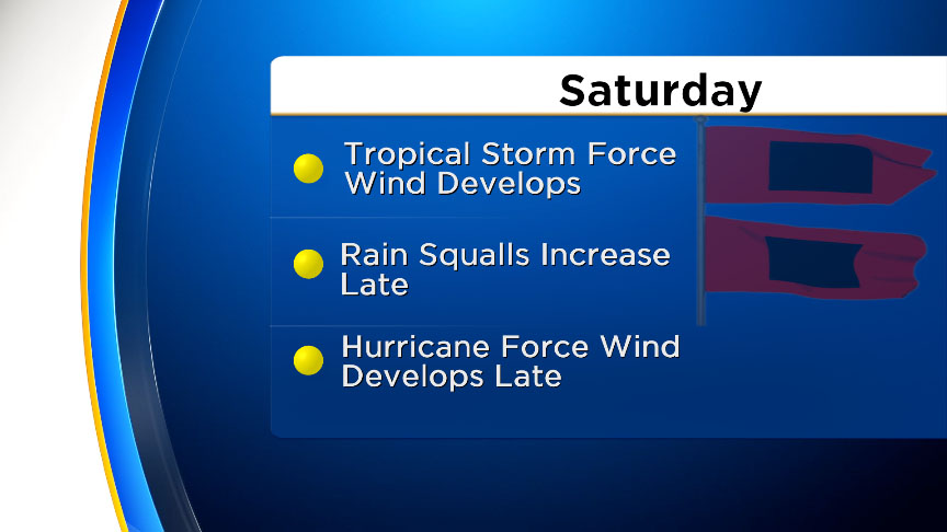
As the bands of rain increase Saturday afternoon and evening the wind will continue to gust and increase in speed throughout the night. The wind will become sustained over 74 mph Saturday evening and only increase from there prior to the potential landfall of Irma.
Saturday night as the wind increases it will create life threatening storm surges along the Keys and coast with some areas possibly seeing surge heights close to 10 feet. The wind and waves may act to push the water well inland and combined with the heavy rain will lead to widespread flooding.
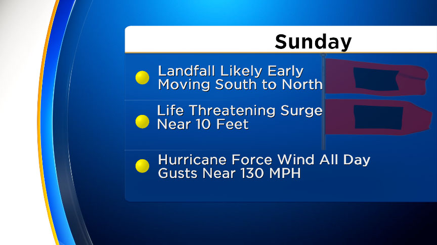
The potential landfall is expected to occur very early Sunday morning. Even without a direct hit in South Florida the massive size of Irma will lead to widespread hurricane force wind and higher gusts. The peak of this occurs Sunday morning with the storm moving north of the area by Sunday evening.
The wind will gradually diminish beginning Sunday night with a slow improvement Monday.
- lick here for ways to prepare yourself for an impending storm from our Hurricane Preps page
- Click here for latest news surrounding hurricanes and the National Hurricane Center
- Click here to see all of the latest maps when a storm forms in the Atlantic
- Click here to download the CBS4 2017 Hurricane Guide (English)
- Click here for Live Weather Blog
- Download the CBS4 Weather App Here